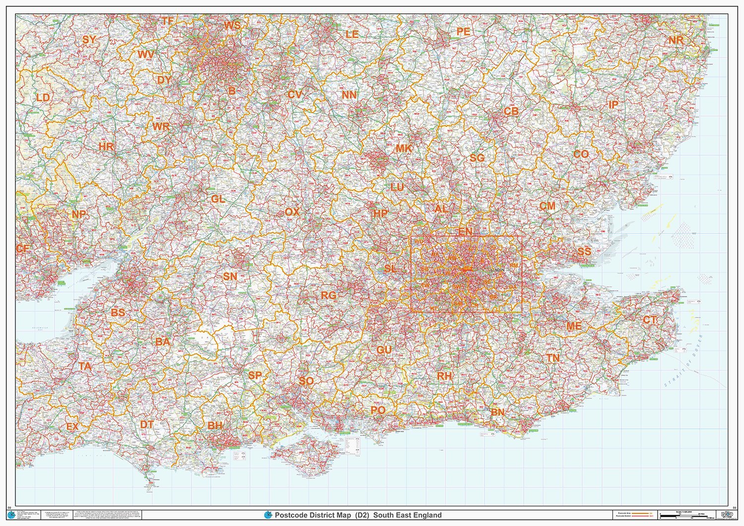
Postcode Sector Map - (S4) - South East England - Wall Map-Plastic Coated 2A (119cm x 168cm)
XYZ Maps
This South East England Sector Wall Map shows detailed Postcode Sector Boundaries (BN1 1, BN1 2) on a Comprehensive Background Double size 2A - 1682 mm x 1189 mm Plastic Coated waterproof / wipeable
Compare prices (1 shop)
| shop | Price | Action |
|---|---|---|
|
|
81,81 GBP | Go to shop |