YNIYUJKL Contour Topographic Map Model,Geology 3D Plate Tectonics Model, Contour Line Reading And Landform Recognition,Geography Classroom Teaching Aid For Earth Science,size_name-L
YNIYUJKL
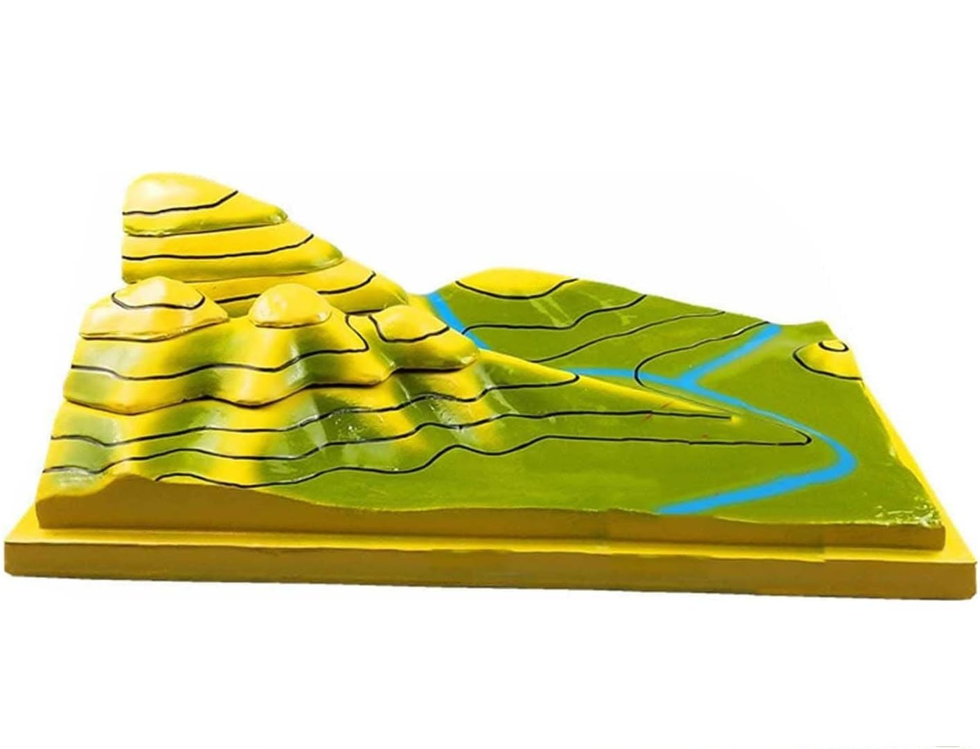
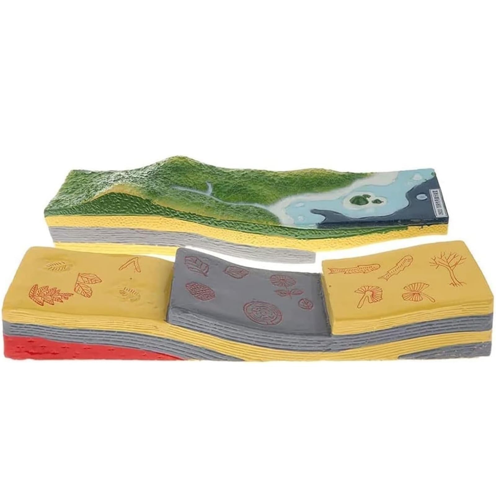
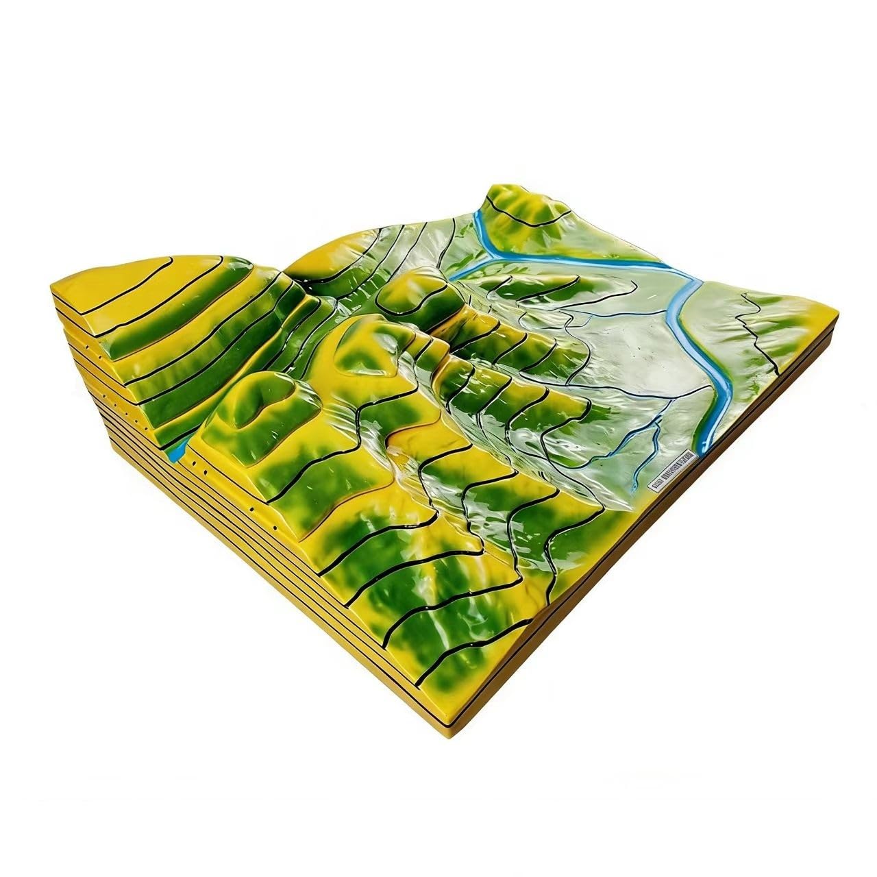
Comprehensive Terrain Features: Includes key geographical features such as mountain tops, ridges, valleys, saddles, cliffs, rivers, alluvial fans, gentle slopes, and steep slopes for detailed observation and study Three-Dimensional Terrain Display: Contour topographic map uses layered and vertical structures to vividly represent various landforms through contour lines, offering a realistic three-dimensional view of terrain. Students can see and feel how concentric circles on a map translate into actual hills, valleys, ridges, and depressions Layered Detachable Design: The main body can be disassembled layer by layer along the contour lines, with both the surface and sectional layers clearly marked with corresponding isotropic lines for easy analysis Durable PVC Construction: Made from premium PVC material, it is lightweight, corrosion-resistant, and durable—ideal for long-term classroom or laboratory use Educational Application: A must-have for middle school, high school, and college-level geography classrooms, as well as for homeschool co-ops and outdoor education programs focusing on navigation and geology
Compare prices (1 shop)
| shop | Price | Action |
|---|---|---|
|
|
119,32 GBP | Go to shop |