YANGLY Practical Military Style MGRS Coordinate Scale Transparent Topographical Map Scale for Sea/Land Navigation Adventures
YANGLY
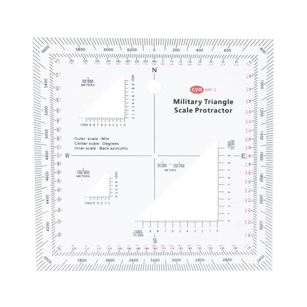
Compatibility The scale map is suitable for use with MGRS, USNG or other metric coordinate systems. 3 Kinds of Scales The coordinate scale protractor is commonly used by armed forces and mariners to mark the map to be surveyed, for use on maps with 1:25,000, 1:50,000, 1:100,000 and 1:250,000. EASY TO READ The compass of the topographic map scale shows both degrees and mil. The printed clear ink makes it easy to read the value. High Quality Materials The transparent coordinate scale is made of high-quality plastic materials, durable and sturdy, wear-resistant, drop-proof, and can be used for a long service life. Wide application: the coordinate scale map is suitable for land or sea navigation or other adventures.
Compare prices (1 shop)
| shop | Price | Action |
|---|---|---|
|
|
9,40 GBP | Go to shop |