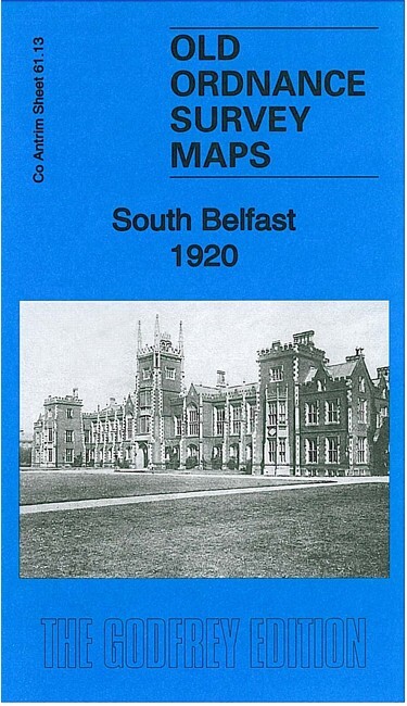
South Belfast 1920 County Antrim Sheet 61.13 by Alison McCloy & Alan Godfrey
This very detailed map covers the area of south Belfast around Queen's University, Botanic Gardens and Stranmillis Road. Coverage stretches from St Thomas church and Eglantine Avenue eastward to Ormeau Bridge, and from University Street southward to Lockview Road. Note that the Co Down area east of the Lagan is left blank.\nThe features include Queen's College, tramways, Exhibition Hall, Botanic Gardens Park, Fisherwick Presbyterian church, Riddel Hall, Dunraven, McArthur Hall, Deaf & Dumb Institution, All Saints church, Bedford Building Works, Soup Works, Stranmillis Road area, University Road area, Assembly's College, Methodist College, streets of terraces but also larger houses in grounds on southern part of map, Irish Confectionery Works etc. On the reverse we include street directory entries for Stranmillis Road and University Road.
Compare prices (2 shops)
| shop | Price | Action |
|---|---|---|
|
|
3,70 GBP | Go to shop |
|
|
3,75 GBP | Go to shop |
Similar products
-

Ballymena 1903 County Antrim Sheet 32.16 by Alan Godfrey
From 3,75 EUR -

Larne 1903 County Antrim Sheet 40.04 by Alan Godfrey
From 3,75 EUR -
-

-

-
