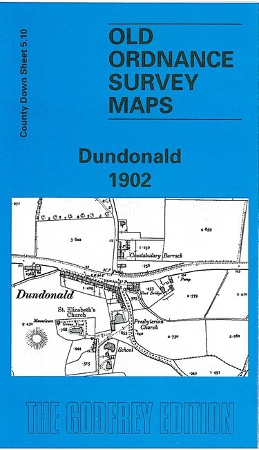
Dundonald 1902 County Down Sheet 5.10 by Peter Carr
This very detailed map covers the village of Dundonald, east of Belfast. The map is double-sided for maximum coverage.\nThe main map covers most of the village, and features include a stretch of railway with Dundonald station, Graham's Bridge, Ballybeen House, St Elizabeth's church, Constabulary Barrack, Church Quarter. On the reverse we include a section of adjacent sheet 5.14 extending coverage south to include Henryville and Peartreehill. There is no sign of urban development.
Compare prices (2 shops)
| shop | Price | Action |
|---|---|---|
|
|
3,45 GBP | Go to shop |
|
|
3,75 GBP | Go to shop |