Yosemite NW Trails Illustrated National Geographic
Topographic MapNational Geographic's Trails Illustrated map of Yosemite NW: Hetch Hetchy Reservoir is designed to meet the needs of outdoor enthusiasts by combining valuable information with unmatched detail of this magnificent region of Yosemite National Park. Expertly researched and created in partnership with the National Park Service, U.S. Forest Service and others, the map's coverage extends from the park's northwestern border to the White Wolf area and features key points of interest of Yosemite Wilderness including Lake Eleanor, Grand Canyon of the Tuolumne River, Tilden Lake and Pate Valley as well as the Emigrant Wilderness in the neighboring Stanislaus National Forest.Get off the beaten path and back again by following precisely mapped trails with mileage markers, including portions of the Pacific Crest and John Muir trails, which are both highlighted. To aid in your navigation of the region, the map includes contour lines, elevations, labeled peaks and summits, waterp
Compare prices (2 shops)
| shop | Price | Action |
|---|---|---|
|
|
11,99 GBP | Go to shop |
|
|
13,86 GBP | Go to shop |
Similar products
-
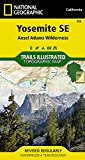
Yosemite SE Trails Illustrated National Geographic
From 11,99 EUR -
Yosemite SW Trails Illustrated National Geographic
From 11,99 EUR -
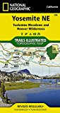
Yosemite NE Trails Illustrated National Geographic
From 11,99 EUR -

Yosemite Day Hikes Trails Illustrated National Geographic
From 12,99 EUR -
-