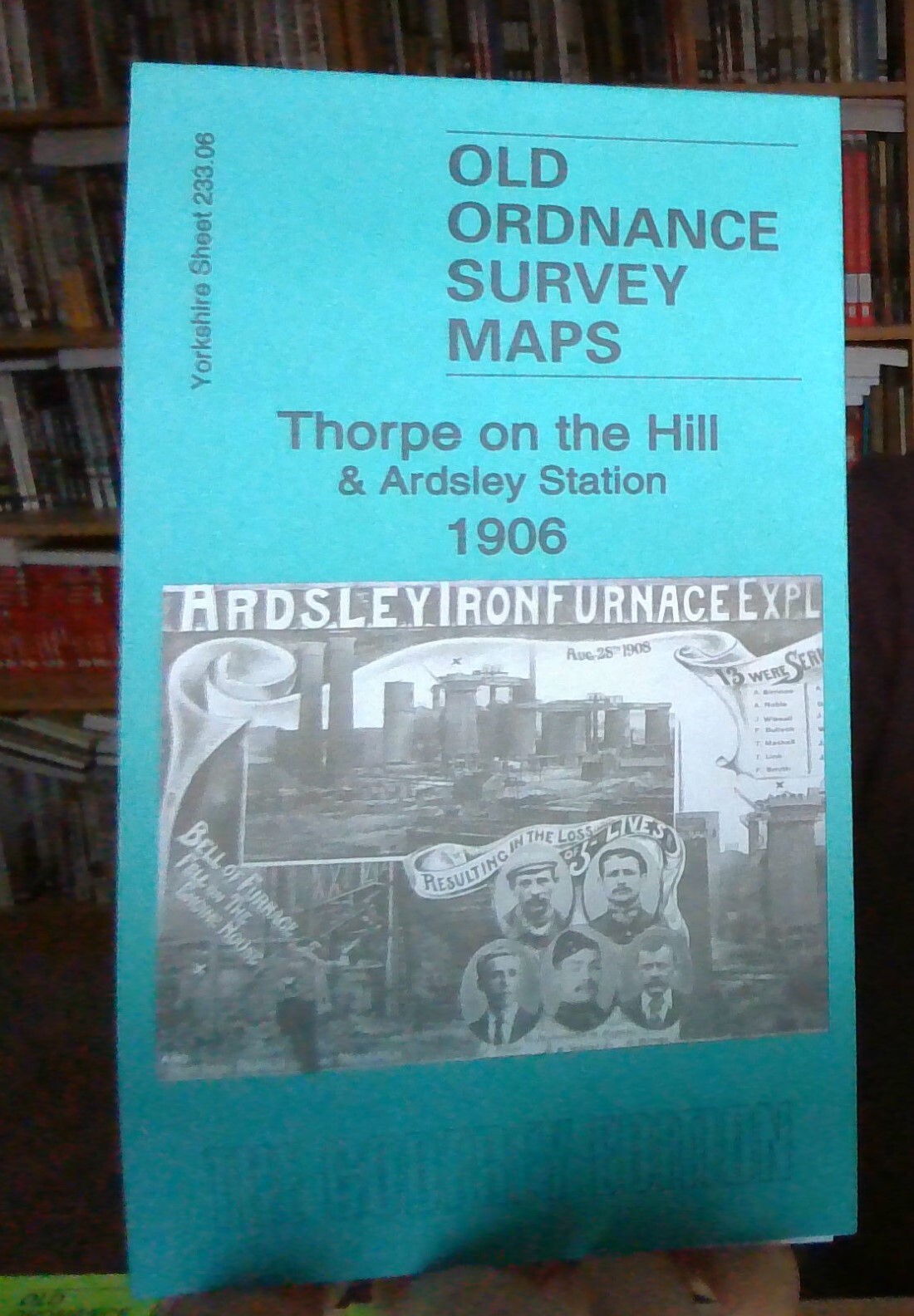
MAP OF Thorpe on the Hill 1906 Yorkshire Sheet 233.06 by Martin Handley NEW
Here are the details of maps for Thorpe on the Hill:\n\nYorkshire 233.06 Thorpe on the Hill & Ardsley Station 1906 - published 2024; intro by Martin Handley. ISBN.978-1-78721-734-8 This detailed map covers the hamlets of Thorpe on the Hill and The Fall.\nFeatures include West Yorkshire Ironworks, GNR railway with Ardsley station, railways and sidings, Fan pit, The Fall, St Gabriel's mission church, Bowling Hall, engine shed, Thorpe on the Hill, Thorpe House, Robin Hood Quarries, E & W Yorkshire Union Railway, brickworks, Lingwell Nook, Lingwell Gate etc.\nThe map links up with Sheets 233.10 East Ardsley to the south and 233.07 Lofthouse to the east.
Compare prices (2 shops)
| shop | Price | Action |
|---|---|---|
|
|
3,45 GBP | Go to shop |
|
|
3,75 GBP | Go to shop |
Similar products
-

Seacroft 1906 Yorkshire Sheet 203.16 by Martin Handley
From 3,75 EUR -

Silsden 1906 Yorkshire Sheet 185.03 by Martin Handley
From 3,75 EUR -

-

-
-
