
MAP OF Kenton & Wealdstone 1936: Middlesex Sheet 10.08 by Alan Godfrey NEW
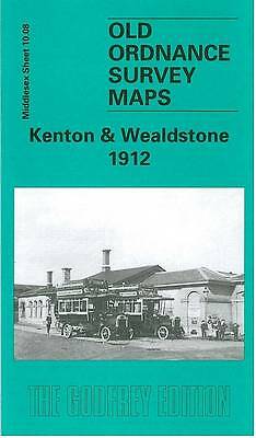
Explore the historical landscape of Kenton & Wealdstone with this detailed map from 1936, a Middlesex Sheet 10.08 edition by Alan Godfrey. Ideal for enthusiasts of local history, the map is a valuable tool for understanding the area's past, presented in a clear and accessible format.\n\nPublished in 2012, this text book offers a glimpse into the past through the medium of a sheet map, utilising English language for its narration. It is an excellent resource for anyone interested in the historical development of Kenton & Wealdstone, or for those looking to expand their collection of historical maps.\nHere are the details of maps for Kenton & Wealdstone:\nMiddlesex Sheet 10.08 Kenton & Wealdstone 1912 - published 2002; intro by Pamela Taylor. ISBN.978-1-84151-449-9 We have published just the one version of this map. The map covers an area stretching from Harrow & Wealdstone station eastward to Kenton, and from Peel Road southward to Kenton station. Wealdstone a.
Compare prices (1 shop)
| shop | Price | Action |
|---|---|---|
|
|
3,45 GBP | Go to shop |
Similar products
-

-

-

-
-

Enfield Lock 1895 Middlesex Sheet 3.13 by Alan Godfrey
From 3,75 EUR -
