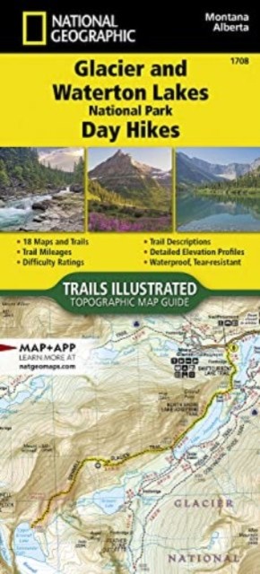
Glacier and Waterton Lakes National Parks Day Hikes Map
Topographic MapTogether, Glacier National Park in the United States and Waterton Lakes National Park in Canada hold the honor of being the worlds first international peace park. Divided by a 19 mile (30.5 km) international boundary, they are further designated by UNESCO as both a biosphere reserve and a World Heritage site, and they are recognized as Dark Sky Parks due to their remoteness.\n The broader landscape around the parks known as the Crown of the Continent ecosystem is a laboratory for collaborative, transboundary conservation that spans from high-peaked mountains to prairie, teeming with diverse plants and animals, making it a spectacular setting for hiking and outdoor recreation. \nThe 18 diverse day hikes featured in Glacier and Waterton Lakes National Parks Day Hikes Topographic Map Guide booklet are organized into sections dividing the parks into six regions for day hikes: North Fork, Lake McDonald, Two Medicine, Saint Mary, Logan Pass, Many Glacier, and Waterton Lakes,p
Compare prices (2 shops)
| shop | Price | Action |
|---|---|---|
|
|
12,99 GBP | Go to shop |
|
|
16,15 GBP | Go to shop |
Similar products
-
-
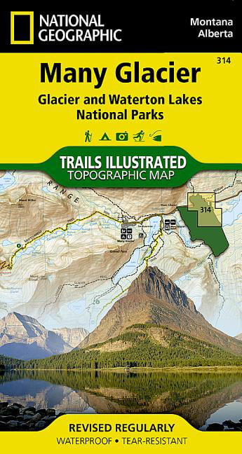
MANY GLACIER Trails Illustrated National Geographic
From 11,99 EUR -

-

Glacier Bay Map Trails illustrated national geographic
From 12,99 EUR -

-